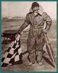
Archie League was one of the airport system's first
flagmen, beginning before 1920 and staying at the field in St. Louis,
Missouri, until a radio tower was installed in the early 1930s. League
then became the airport's first radio controller. The radio controllers
could provide some information to the pilots to help them land.
As of 1935, there were only about 35 such radio
controllers. More often, flagmen were replaced by a system of red and
green airport lights to show the runway threshold and sides, to allow
pilots to judge their remaining distance and angle they should take for
landing based on how narrow the parallel beams appeared to them from a
distance.
Airports had begun using lights in the late 1920s, when
fields were marked with rotating lights so they could be found after dark.
In the early 1930s, airports installed the earliest forms of approach
lighting, which indicated the correct angle of descent and whether the
pilot was right on target. These were called the glidepath or glideslope.
Gradually, the colours of the lights and their rates of flash became
standard worldwide based on International Civil Aviation Organization (ICAO)
standards.
Approach lighting can be oriented to accommodate any
obstructions located near the airport that the pilot may need to avoid
before beginning his descent to the runway. Lights can even be set at a
second angle for larger aircraft because those cockpits are farther off
the ground and the angle of descent will look different to pilots in these
planes. Pilots flying into fields without any staff can often turn landing
lights on or off themselves or change their brightness by tuning their
radio to a certain frequency and clicking their transmitter.
Radio navigation aids also assisted in landing. One
type, introduced in 1929, was the four-course radio range, where the pilot
was guided by the strength of Morse code signals. Another type that was
tried experimentally was the low-frequency radio beam. These radio beams
flared outward from the landing point like a "v," so at the point farthest
from the runway, they were wide, and it was easy for the pilot to fly
between the arms of the "v." But near the landing point, the space between
the beams was extremely narrow, and it was often easy for the pilot to
miss the exact centre point that he had to hit for landing. Another new
method had a pilot tune into a certain frequency at a checkpoint far from
the airport, then use a stopwatch to descend at a precise rate to the
touchdown area of the runway. This method also proved difficult.
The development of RADAR at the beginning of World War
II allowed the military to use a new landing aid called ground control
approach (GCA). GCA consisted of two six-inch (15-centimeter) radar
displays using cathode ray tubes (CRTs). One CRT displayed the approaching
aircraft while the radar operator directed pilots into a waiting position
using voice radio. The other CRT display helped determine how the pilot
should steer to find the proper heading and approach angle to land. Then a
controller literally talked the pilot down. GCA used mobile trailers that
could roll to a new runway or even a new airport when needed. Today's
military still uses an advanced version of this system, called precision
approach radar. GCA proved its worth during the Berlin Airlift in
1948-1949 when as many as a thousand flights landed each day.
The instrument landing system (ILS) incorporated the
best features of both approach lighting and radio beacons with higher
frequency transmissions that painted an electronic picture of the
glideslope onto a pilot's cockpit instruments. U.S. Army Air Service
Captain Hegenberger and Lieutenant Jimmy Doolittle each made a blind
flight and landing that tested a primitive form of the ILS in 1929.
The Bureau of Air Commerce adopted ILS in 1934 and
began installing it at 36 airports. But airlines protested that the system
was un-flyable, partly because it was expensive to install the necessary
instruments in their aircraft. An alternate form of ILS called air track,
which had been tested in 1928 by engineers from the U.S. Bureau of
Standards, eventually became standard. The first landing of a scheduled
U.S. passenger line using air track was on January 26, 1938, as a
Pennsylvania-Central Airlines Boeing 247-D flew from Washington, D.C. to
Pittsburgh and landed in a snowstorm using only the air track system.
Air track consisted of an electronic glidepath signal
that is beamed to the aircraft. This indicated the correct angle of
descent to the runway. The system also used two marker beacons that let
the pilot know when checkpoints were passed as the airport neared.
Finally, a beam called a localizer let the pilot know whether to steer to
the right or left to stay on the runway centreline. Equipment in the
airplane allowed the pilot to receive the information that was sent so he
could keep the craft on a perfect flight path.
On January 15, 1945, the U.S. Army introduced an ILS
with a higher frequency transmitter to reduce static and create straighter
courses, called the Army Air Forces Instrument Approach System Signal Set
51. In 1949, the ICAO adopted this Army standard for all member countries.
In the 1960s, the first ILS equipment for fully blind landings became
possible.
The ILS in 2001 remains basically unchanged. Pilots fly
along a glideslope that is determined by information received by the pilot
electronically. But landing still requires that he actually see the
runway. At a particular height and distance from the runway, called the
decision height, the pilot can see the runway well enough to land the
plane.
Microwave landing systems were developed in the 1980s
and were intended to replace the ILS in the United States. This system
would have allowed pilots to enter a path to land from more directions
than the ILS and descend at a choice of paths best matched to their type
of aircraft. These different landing patterns can help reduce noise around
airports and keep small aircraft away from the dangerous vortices behind
large aircraft. But microwave systems have been delayed in the United
States due to funding problems and uncertain developments from competing
technology. In Europe, however, the microwave landing system is replacing
the ILS. In the United States, the FAA is considering the use of the
global positioning system (GPS) instead of or in addition to microwave
systems. The GPS uses satellites for navigation between airports and is
exceedingly precise.
Helicopters have used visual landing procedures for
most of their history, but on June 12, 1987, the Federal Aviation
Administration (FAA) opened its national concepts development and
demonstration heliport. This research heliport was fully equipped with
items such as a microwave landing system as well as precision approach
path indication lights like those used by fixed-wing aircraft.
Pilots cannot simply navigate to an airport and then
fly into the runway using one of these landing aids. Federal regulations
and procedures require aircraft to approach airports at certain altitudes
and in certain patterns well before they are ready to land. If excess
traffic requires them to wait their turn, they must follow a holding
pattern that keeps them up to 50 miles (80 kilometres) from the airport.
Holding patterns look like a series of invisible racetrack ovals, with
each circling aircraft in a stack at 1,000-foot (305-meter) intervals at
altitudes as high as 23,000 feet (7,010 meters). As each aircraft is
cleared to enter its final approach to land, the pilot exits the bottom of
the stack while all others descend to the next lowest level, as though on
a circular ladder. If a pilot misses his touchdown, he must climb and then
follow strict procedures in leaving the airport to circle and hold again.